Places
AzotusAlternative names: Tell Ashdod, AshdodPlace descriptionAncient Ashdod (Mesogaius Azotus) is located about 7 km south of the modern city of
Ashdod, and about 4 km east of the Mediterranean coast. The site has both an acropolis
(ca 80 dunams; 20 acres) and a lower city (ca 280 dunams; 70 acres). The Arab village
Isdud, inside which the remains are located, preserves its name. Nine seasons of
excavations were carried out between 1962 and 1972 (first by Pittsburgh Theological
Seminary, The Pittsburgh Carnegie Museum, and the Israel Department of Antiquities, led
by D. N. Freedman, J. Swauger and M. Dothan). The excavations uncovered remains dating
from the Middle Bronze Age to the Byzantine period (Dothan 1993). Babylonians destroyed
the important Philistine city of Ashdod at the end of the Iron Age. During the Persian
period, there was animosity between Judah and Ashdod, although some men of Judah were
marrying Ashdodite women, who spoke their own distinctive dialect (Neh 13:23-24; Lemaire
1995). The discovery of fourth century BCE coins inscribed with the full name of
“Ashdod” proves that a mint operated in the city during the Persian period: it seems
that coins with the letters “a” (), aleph) and “sh” (#, shin) have simply shortened the
name “Ashdod” (Meshorer 1989; Gitler 2000). A large public building from the Persian
period was unearthed, possibly an administration center for the city. From the same
period, a mixed assemblage of pottery vessels was found containing both local and
imported ware (Attic ware), Persian style jewelry, and an Aramaic ostracon dated to the
beginning of the fourth century BCE, recording a quantity of wine sent by a certain
Zebadah (Naveh 1971). Because Ashkelon is not mentioned in Nehemiah, scholars tend to
conclude that the southern coastal plain of the Persian satrapy of Abar Nahara belonged
to the district of Ashdod. In all other sources dating to the Persian period, however,
it is the name Ashdod that is missing, so it does not seem justified to consider Ashdod
as having supremacy over Ashkelon, especially at the end of the Persian period, as is
borne out by the coins from Ashkelon (Stern 1983: 243-44; Lemaire 1994). Ashdod minted
coins only during the Persian period, and not during the Hellenistic period. The city is
mentioned twice in Hellenistic sources. Judah Maccabee fought against Ashdod and its
villages, destroying their altars and idols (1 Macc 5:68). Jonathan, his brother, led a
campaign in 147 BCE against Apollonius, the representative of Demetrius II, at Ashdod (1
Macc 10:80-85); after Jonathan had captured Jaffa, Apollonius tried to ambush him as he
was traveling to Ashdod (on the geography, see Bar Kochva 1975). The ambush was
unsuccessful, and Jonathan pressed on to Ashdod, captured it, and destroyed its
villages. Many residents of the city took refuge in the temple of Dagon, but Jonathan
burnt it to the ground (see also Ant. 13:99-100). After this victory the district of
Ekron was annexed to Judea (1 Macc 10:89; Ant. 13.102). When Ptolemy VI Philometor, with
the help of Alexander Balas, led his military campaign along the coast, the citizens of
Ashdod complained about Jonathan’s excessive brutality. Ptolemy, however, did not
respond to their complaints, possibly out of fear of Jonathan’s military power (1 Macc
11:4-7; Ant. 13:103-105). The sources suggest the city was severely destroyed, although
it was not set on fire, possibly because Jonathan’s ultimate aim was the destruction of
the Temple of Dagon (Kasher 1990: 39-94). John Hyrcanus ruled in Gezer, on the border of
Ashdod’s territory (1 Macc 14:34); during his campaign against Cendebeus, he burnt the
towers and fortifications in Ashdod’s district (1 Macc 16:10). Nevertheless, Ashdod
continued to exist as one of the Hasmoneans’ strongest opponents, despite its military
defeats. Ashdod was a minor city compared to Ashkelon, Gaza, and even Yavneh-Yam: there
was little maritime activity, the city did not mint any coins in the Hellenistic period,
no important personalities are known to have come from Ashdod (as they did from
Ashkelon), and Ashdodites are not known in other parts of the Mediterranean world.
Nevertheless, 1 Maccabees suggests that it ruled over a relatively large territory.
Excavations at Tell Ashdod exposed a well-planned Hellenistic city, including a central
building that may have served as the city’s agora. Large storage jars were found in its
central hall, where cultic vessels in one corner implied cultic activities. These second
century BCE discoveries come from a stratum of ash, most likely a destruction layer. The
latest coin discovered at Ashdod was dated to 114 BCE, during the rule of Antiochus II
(Dothan and Freedman 1967: 17-24). Ashdod seems to parallel other cities along the
coast, such as Yavneh-Yam, with destruction layers related to the rule of John Hyrcanus,
though no campaign is mentioned in the historical sources (see Finkielsztejn 1998;
Safrai 2000). If the final conquest of Ashdod came under John Hyrcanus, it would be
evidence of the Hasmoneans’ enduring determination to control the city. In any case, the
city appears in the list of cities captured by Janneus (Ant. 395.13); it is mentioned as
one of the cities rehabilitated after Pompey’s conquest (War 1.156; Ant 14.75) and then
rebuilt by Gabinius (War 1.165-166; Ant. 14.87-88). The archaeological evidence,
however, suggests that the city was not rebuilt until the days of Herod the Great, so
that it seems that the earlier reconstruction was more political propaganda than
reality. The city was apparently ceded to Herod the Great in 30 BCE; this is not
explicitly stated but is deduced from Herod’s will, by which Ashdod was bequeathed to
his sister Salome (War 2.98; Ant. 17.189). It is also assumed that on Salome’s death the
city was given to Livia, Augustus’ wife, though Josephus does not mention Ashdod
specifically (War 2.167; Ant 18.31). Herodian Ashdod generally preserved the layout of
the Hellenistic city. One should note the rich ceramic assemblage, especially the
eastern terra sigillata ware and Megarian bowls (Dothan and Freedman 1967: 24-27).
Vespasian conquered Ashdod during the first revolt and posted a permanent garrison there
(War 4.130). Either the city had previously been conquered by the Jews or its Jewish
population constituted an apparent danger (Schürer-Vermes 2.109). According to the
excavators, the destruction layer of the Herodian city was connected with Vespasian’s
conquest, after which the city declined, while Ashdod-Yam took on increasing importance.
Like other coastal cities, the inland city of Ashdod built a port city on the coast,
Ashdod-Yam (Azotus Paralios), mentioned in a number of sources from the late Roman and
Byzantine periods (Avi-Yonah 1976: 34). There are two relevant ancient sites. To the
north is Tel Mor, situated on the northern banks of Nahal Lachish (117.136), Ashdod’s
extension to the sea from the Middle Bronze Age until the end of the Iron Age.
Excavations in the late 1950s and early 1960s reveal that the city fell at the end of
the Iron Age, together with Ashdod, at the hands of the Assyrian king Sargon II. The
latest remains on Tell Mor date to the Hellenistic period: a large building on the
eastern slope of the tell and an industrial installation to extract purple dye from
murex shells, which operated from the beginning of the third century until the second
half of the second century BCE (Dothan 1973). Jonah’s Hill (en-Nabi Yonas), another site
on the southern banks of Nahal Lachish, has remains from the Persian, Hellenistic, and
Roman periods. There is also a small fort from the Persian period just north of Nahal
Lachish, dated to the fifth century BCE (Porath 1974). On the coast south of Ashdod is
the site of Ashdod-Yam, with the fortress Qal‘at el-Minat Isdud at its summit (114.131),
where excavations were carried out in 1965-1968 (Tel Aviv-Jaffa Museum of Antiquities,
led by J. Kaplan). Only remains from the Iron Age were uncovered (Kaplan 1969), but the
archaeological survey conducted north of the fortress showed that the site expanded in
the late Roman and Byzantine periods, when the inland site of Ashdod was losing
importance. The historical sources demonstrate that Ashdod-Yam reached its peak during
the Byzantine period, as the Madaba map also suggests. Its central feature was the
fortress that, according to the excavations recently carried out, dated to the early
Islamic period, though some evidence of the Byzantine settlement was also found
(Nachalieli et al. 2000). Images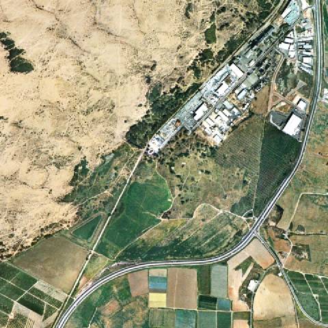 Azotus 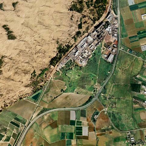 Ashdod_Azotus_TAshdo 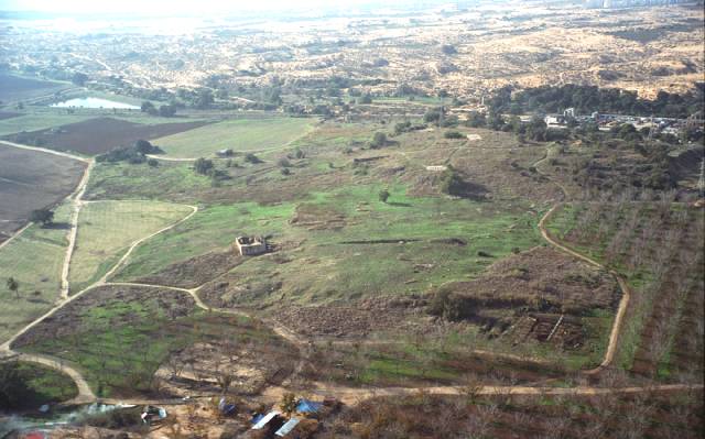 Ashdod tell aerial from east, tb 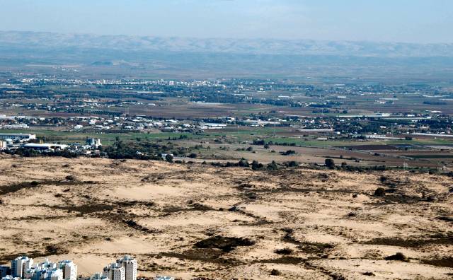 Ashdod tell aerial from west, tb121704852 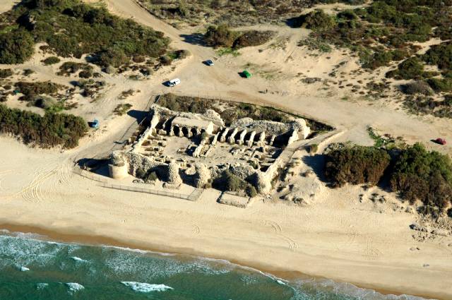 Ashdod-Yam aerial from west, tb121704854 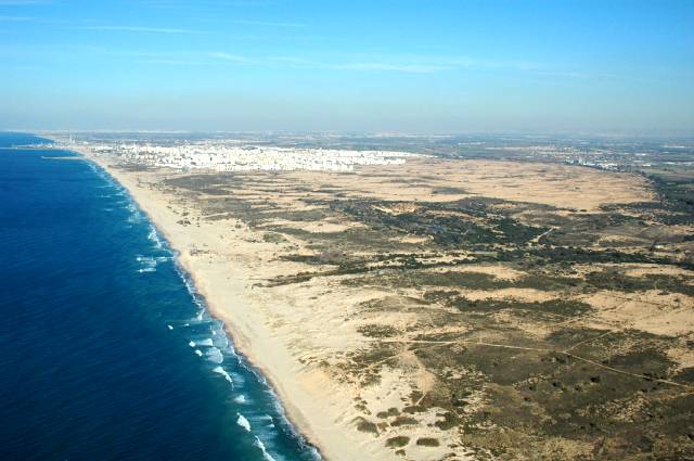 Ashdod S of coastal plain tb121704850 Passages - Flavius JosephusThe Judean Antiquities (Brill)The Judean Antiquities (Whiston)The Judean War (Whiston) |